
Last Updated: 09:44 GMT — Sunday, 25 January 2026
Storm Ingrid—named by Portugal’s IPMA on Thursday evening—made landfall across the UK overnight, bringing peak gusts of 70mph and prolonged heavy rain. While wind speeds are easing slightly, the primary danger has now shifted to severe flooding and coastal surges as saturated ground struggles to absorb further rainfall.
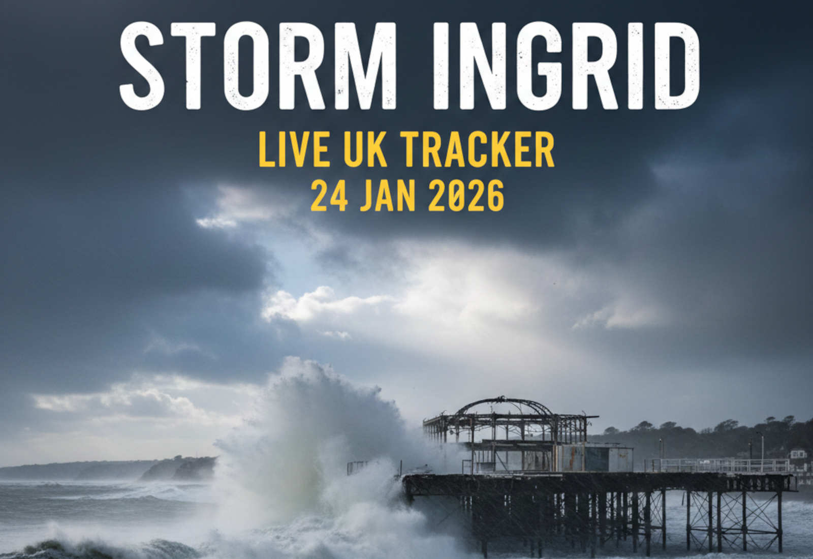
The South West has suffered significant structural damage, with Teignmouth’s historic Grand Pier partially destroyed by storm waves. Flood warnings remain active across Dorset, Wales, and Scotland as the slow-moving system continues northwards.
For detailed preparation advice, see our full storm damage prevention guide below.
Complete Guide
Storm Damage Prevention
Every autumn, the same thing happens. A named storm rolls in off the Atlantic, the Met Office issues an amber warning, and half the country discovers that garden furniture, wheelie bins, and loose roof tiles become projectiles at 70mph.
Read the Full Guide: Storm Damage Prevention →
☔ Storm Prep: Be ready for the next severe weather event with our guide: “Storm Damage Prevention: How to Prepare for a Storm Before It Hits” →
🔴 LIVE UPDATES
09:15 GMT (Sunday 25 Jan) — Storm Ingrid warnings EXPIRED. Scotland/Northern Ireland yellow warnings ended 09:00 as forecast. Storm has passed UK. Clean-up and damage assessment begins.
09:00 GMT — Dawlish railway line CLOSED INDEFINITELY. Sea wall collapsed in TWO locations. GWR issued only second BLACK ALERT in history (first was 2014 storm – 8 week closure). No reopening date announced. Rail replacement coaches continue.
FINAL CASUALTY COUNT: ZERO deaths, ZERO serious injuries reported from Storm Ingrid.
FINAL DAMAGE SUMMARY:
- Teignmouth Grand Pier (partial collapse, 157-year-old structure)
- Dawlish sea wall (double breach – unprecedented for £165m resilience works)
- Teignmouth seafront (benches, paving, flower beds destroyed)
- Exmouth seafront (rendered impassable)
- Multiple road closures (trees, flooding)
- Rail: Dawlish/Newton Abbot corridor severed, Par-Newquay, Liskeard-Looe affected
FINAL FLOOD STATS: 13 warnings (SW England), 135 alerts (UK-wide) as of final Met Office update.
INFRASTRUCTURE: No widespread power failures. No water supply disruptions. Storm was infrastructure-heavy but operationally clean.
NEXT WEATHER THREAT: Tuesday 27 January – Deep low pressure approaching from southwest. Yellow rain warnings issued for Northern Ireland (06:00-15:00). 15-25mm widely, 40-60mm on high ground, strong southeasterly winds.
01:15 GMT (Sunday 25 Jan) — Dawlish line REMAINS CLOSED into Sunday. GWR JourneyCheck shows trains still not calling at Dawlish, Teignmouth, or Newton Abbot. Rail replacement coaches continue. No official reopening time announced. Tickets valid until Sunday 25 January.
01:15 GMT (Sunday 25 Jan) — Dawlish line REMAINS CLOSED into Sunday. GWR JourneyCheck shows trains still not calling at Dawlish, Teignmouth, or Newton Abbot. Rail replacement coaches continue. No official reopening time announced. Tickets valid until Sunday 25 January.
01:00 GMT — Scotland/Northern Ireland yellow warnings EXPIRE at 09:00 Sunday. Overnight rainfall totals being assessed across affected areas.
00:45 GMT — Additional Teignmouth damage confirmed. Mayor reports benches, flower beds, and paving stones near seafront damaged by unusually high winds and strong waves – beyond just pier collapse.
00:30 GMT — Environment Agency flood stats unchanged: 13 warnings (flooding expected) across SW England, 135 alerts (flooding possible) UK-wide. Ground saturation remains critical issue.
23:45 GMT — POWER CUT STATUS: No widespread power outages reported from Storm Ingrid despite Met Office warnings of “possible short-term power cuts.” Localised outages reported in Devon and Cornwall Friday evening have been largely restored. Storm much less destructive than Storm Éowyn (Jan 24 2025) which left 750,000 Irish homes without power.
23:45 GMT — WATER SUPPLY: No water supply disruptions reported across UK from Storm Ingrid. Ground saturation causing flooding but no infrastructure failures at treatment plants or pumping stations.
23:45 GMT — Wales yellow warning EXPIRED at 22:00. Storm Ingrid’s worst has passed for southwest England and Wales. Cleanup and damage assessment to begin Sunday.
23:40 GMT — DAMAGE ASSESSMENT: Confirmed storm damage limited to:
- Teignmouth Grand Pier (partial collapse)
- Dawlish sea wall breach
- Multiple road closures (fallen trees)
- Localised flooding (roads/fields)
- Rail infrastructure (Dawlish, Liskeard-Looe, Par-Newquay)
23:30 GMT — Scotland and Northern Ireland warnings CONTINUE overnight until 09:00 Sunday. 20-30mm rainfall expected with winds gusting 45-55mph on coasts. Ground already saturated – further flooding likely.
23:00 GMT — Dawlish rail line status UNCONFIRMED at end of Saturday. No official reopening announcement despite 18:00 deadline passing 5+ hours ago. Assume line remains closed until official confirmation. Check National Rail before travelling Sunday.
21:00 GMT — Wales yellow rain warning EXPIRES at 22:00 tonight (10pm). Storm Ingrid drifting north over Celtic Sea – worst of weather passing for southwest England and Wales.
20:45 GMT — Scotland and Northern Ireland warnings ACTIVE. Yellow rain warnings now in force until 9am Sunday. 20-30mm rainfall, winds gusting 45-55mph on coasts. Ground already saturated – further flooding likely.
20:30 GMT — Flood warnings REDUCED. Down to 13 warnings (flooding expected) across southwest England from earlier peak of 211. 135 flood alerts (flooding possible) remain across UK.
20:00 GMT — NEXT WEEK WARNING ISSUED: Met Office confirms deep low pressure Tuesday bringing coastal gales, heavy rain, and possible disruptive snow on higher ground (northern England/Scotland). New yellow warning: Monday 6pm – Tuesday 2pm for Devon, Cornwall, Somerset, Wales. 50-80mm on Dartmoor/Exmoor.
18:30 GMT — Dawlish line status UNKNOWN. The 18:00 (6pm) disruption deadline has passed with no official reopening announcement from Network Rail or GWR. Check live departure boards before travelling.
18:15 GMT — Dawlish line closure deadline PASSED with no reopening announcement. The 18:00 (6pm) disruption window has now expired. National Rail and GWR have not confirmed whether line has reopened or extended further. Check live departure boards before travelling.
17:00 GMT — Environment Agency: 13 flood warnings (flooding expected) remain active across southwest England, down from 211 earlier today. 135 flood alerts (flooding possible) remain across UK. Ground saturation continues.
17:00 GMT — NEXT WEEK WARNING: Met Office warns deep low pressure system forming for Tuesday, bringing risk of coastal gales, heavy rain, and possible disruptive snow across higher ground of northern England and Scotland.
16:30 GMT — Dawlish line closure EXTENDED. GWR now reports disruption expected until 18:00 GMT (6pm). 12ft (4m) waves continue to hit the damaged sea wall. Line remains closed for safety – no reopening confirmed.
16:15 GMT — Wales yellow rain warning EXTENDED to 22:00 GMT (10pm) tonight. Storm Ingrid drifting north through Celtic Sea with bands of heavy showers merging into prolonged rain through afternoon and evening.
16:08 GMT — Dawlish rail line status UNKNOWN. Safety inspection completed but Network Rail has not issued reopening confirmation. Disruption was expected “until 16:00” – that window has now passed with no update. Check National Rail before travelling.
15:45 GMT — Wales yellow rain warning remains active until 22:00 tonight. Additional 20-40mm forecast for Pembrokeshire and Ceredigion, with 50mm possible in exposed locations. Winds approaching gale force along coast.
15:30 GMT — Flood warnings remain high across UK. 211 active warnings (Environment Agency). Ground saturation critical – even modest rainfall causing road flooding and field runoff.
10:40 GMT — Exmouth seafront remains impassable after overnight storm surge. Coastguard teams rescued multiple stranded vehicles from Morton Crescent and The Esplanade. Devon Highways closed the road and urged motorists to stay away from coastal areas.
10:20 GMT — The 157-year-old Victorian Grand Pier in Teignmouth has suffered structural failure, with the seaward end washed away during Friday night’s storm surge. The damage is visible from the seafront and represents significant heritage loss.
10:00 GMT — Perth and Kinross Council reports multiple road closures including the A94 and Queen’s Bridge due to flooding. Three people were rescued from stranded vehicles in Aberdeenshire on Thursday.
09:30 GMT — Sandbanks Ferry resumes limited service after suspension earlier this morning. Check Bournemouth-Swanage Motor Road website before travelling.
08:45 GMT — Flooding reported in Fowey and Mevagissey streets during Friday morning high tide, with wave overtopping causing water to surge into coastal areas.
08:15 GMT — Environment Agency issues new flood warnings for River Wey (Surrey). Avoid Tilford and Elstead areas.
🌊 Structural Damage & Coastal Impact
Teignmouth Grand Pier Destroyed
Mayor Cate Williams confirmed this morning that part of the town’s Victorian-era Grand Pier has been washed away during overnight storm surge. “Wild waves” combined with peak high tides caused structural failure at the pier’s seaward end. The 157-year-old landmark took a “real battering” with damage described as the worst since Storm Emma in 2018.
Exmouth Seafront Impassable
The seafront remains closed after coastguard teams rescued multiple vehicles stranded by wave overtopping. Morton Crescent and The Esplanade are both underwater, with Devon Highways urging complete avoidance of coastal routes.
Coastal Flooding
High tides combined with 60mph southwesterly gales have overtopped sea defences along the Dorset and Devon coasts. The Environment Agency has active flood warnings for:
- Chiswell and the Fleet, Weymouth
- West Bay Harbour
- Portland Bill to Chesil Beach
- Exmouth seafront and coastal roads
Residents in these areas have been advised to deploy flood barriers and move vehicles to higher ground ahead of the next high tide at approximately 16:30 GMT.
🗺️ Regions Most Affected
South West England
Devon:
- Exeter-Newton Abbot rail line closed (Dawlish sea wall damaged)
- Exmouth seafront impassable – multiple vehicle rescues
- Teignmouth pier partially destroyed
- Localised power outages reported
Cornwall:
- Gusts to 70mph overnight
- Fowey and Mevagissey streets flooded during high tide
- Coastal road closures
- Large debris (logs) floating in Readymoney Cove
Dorset:
- Active flood warnings along entire coastline
- Sandbanks Ferry disrupted (limited service resumed)
- Wave overtopping at West Bay
Wales
- Yellow rain warning until 22:00 Saturday
- 20-40mm additional rainfall expected (50mm in exposed areas)
- Flash flooding reported in Pembrokeshire
- Ground already saturated – rapid runoff into rivers
Scotland
Perth and Kinross:
- Multiple road closures including A94 and Queen’s Bridge
- Heavy rain and rapid snow thaw creating hazardous conditions
Aberdeenshire:
- Three people rescued from stranded vehicles Thursday
- Two extracted from minibus near Kintore
- One rescued near Banchory
National:
- Hazardous driving conditions on A9 and A82
- Localised river flooding across Perthshire
South East England
Surrey:
- River Wey burst banks near Tilford
- Road closures in Elstead and surrounding areas
- New flood warnings issued this morning
🚗 Transport & Infrastructure Disruptions
Rail Network
Dawlish Sea Wall – BLACK ALERT: Network Rail issued a “black alert” (highest warning level) for the Dawlish sea wall. The line between Exeter St Davids and Newton Abbot is closed until at least 14:00 today pending safety inspections. Replacement coaches are running. Disruption expected until 16:00 at the earliest.
Road Closures
- Devon: Exmouth seafront (Morton Crescent, The Esplanade)
- Cornwall: Multiple coastal routes closed
- Surrey: Roads near Tilford and Elstead (River Wey flooding)
- Scotland: A94, Queen’s Bridge (Perth and Kinross)
- Dorset: Coastal routes subject to wave overtopping
Ferry Services
- Sandbanks Ferry: Limited service resumed after earlier suspension due to high tides
Power Outages
Localised outages reported in Devon and Cornwall where gusts reached 60-70mph overnight. Engineers working to restore supply.
🌦️ Current Weather Warnings
The Met Office has 4 active weather warnings across the UK:
Yellow Warning: Rain (Wales & South West England)
- Active until: 22:00 tonight (Saturday 24 January)
- Areas: Pembrokeshire, Ceredigion, Devon, Cornwall
- Rainfall: Additional 20-40mm, with 50mm possible in exposed locations
- Risk: Flash flooding, difficult driving conditions, spray and localised flooding
Yellow Warning: Rain (Scotland)
- Status: Ongoing
- Impact: Heavy rain and snow thaw creating hazardous driving conditions
- Areas: Central and southern Scotland
📌 Storm Ingrid: What to Do RIGHT NOW
If you’re in an affected area, take these actions immediately:
Coastal residents (Dorset, Devon, Cornwall):
- Deploy flood barriers before 16:30 high tide
- Move vehicles away from seafront parking immediately
- Charge all devices (power cuts possible during next surge)
- Stay away from coastal areas – do not attempt to view waves
Inland flood zones (Surrey, Wales, Scotland):
- Clear drains and gutters of storm debris NOW
- Move valuables upstairs if ground floor at risk
- Monitor Environment Agency alerts every 2 hours
- Check on elderly/vulnerable neighbours (travel-lock risk)
Everyone:
- Do not drive through standing water (depth unknown, currents strong)
- Do not park under trees (saturated soil = unstable roots)
- Have your blackout box and grab bag accessible
- Check National Rail before travelling
- Avoid all non-essential travel in affected regions
🔮 What Happens Next
Saturday Evening (24 Jan)
- Rain warnings expire 22:00 GMT for Wales/South West
- Wind speeds drop to 30-40mph
- Next high tide: 16:30 GMT (coastal surge risk continues)
- Scotland warnings remain active
Sunday (25 Jan)
- Flood warnings remain active as rivers peak
- Rail services resume pending Dawlish safety checks
- Ground saturation remains critical (tree-fall risk high)
- Cleanup operations begin in coastal areas
Early Next Week
- Drier conditions return Monday/Tuesday
- Infrastructure damage assessments underway
- Full extent of Teignmouth pier damage evaluated
- River levels slowly recede
🧠 UK Prepper Hub Tip: Saturated Ground Hazards
When the UK experiences “back-to-back” storms, the danger isn’t just the wind speed—it’s the ground’s saturation point.
Saturated soil loses its grip on tree roots and increases the speed of runoff into rivers. Even if the wind feels calmer today, the risk of falling trees and “flash” river rises remains at an all-time high.
Why this matters:
- Trees can fall in winds as low as 30mph when roots are waterlogged
- River levels can rise dramatically within 1-2 hours after rainfall stops
- Ground compaction means rainwater runs straight into drains and rivers rather than soaking in
- Urban areas particularly vulnerable to flash flooding
What to do:
- Avoid parking under trees for the next 48 hours minimum
- Stay alert for rapid river rises even after rain stops
- Keep away from riverbanks and coastal paths
- Report fallen trees blocking roads immediately
Frequently Asked Questions
Q: Is Storm Ingrid still active?
Yes. While wind speeds are easing, heavy rain continues across Wales and Scotland until Saturday evening (22:00 GMT). Flood risk remains critical through Sunday as saturated ground cannot absorb further rainfall.
Q: When will the Dawlish railway reopen?
Network Rail expects safety inspections to complete by 14:00 GMT Saturday. The line will reopen once sea wall damage is fully assessed. Current estimate suggests disruption until 16:00, but this may extend if damage is significant.
Q: Should I travel this weekend?
Avoid non-essential travel in Devon, Cornwall, Dorset, Wales, and Scotland. Check National Rail and National Highways before setting out. Many coastal roads remain closed or impassable.
Q: Where can I check live flood warnings?
- Environment Agency: https://check-for-flooding.service.gov.uk/
- Met Office warnings: https://www.metoffice.gov.uk/warnings
- UK Prepper Hub Situation Room: https://ukprepperhub.co.uk/situation-room/
Q: How bad is the Teignmouth pier damage?
The seaward end of the 157-year-old Victorian pier has been completely washed away. This is the worst damage since Storm Emma in 2018. Full structural assessment is underway.
Q: What’s the next high tide time?
Approximately 16:30 GMT Saturday 24 January. This is the critical window for further coastal flooding and wave overtopping.
Current National Stats
- Total flood warnings: 211 (Environment Agency)
- Active Met Office weather warnings: 4
- Named storm status: Active (Storm Ingrid)
- Peak recorded gust: 70mph (Cornwall, Friday overnight)
This post will be updated throughout the day as Storm Ingrid progresses. Check back regularly for the latest on road closures, flood alerts, and rail disruption.
Next update expected: 14:00 GMT (Dawlish rail line assessment)
📡 Find Us Everywhere
Daily briefings, prep guides, and real-time updates across every platform. Pick yours.
Free. No commitment. Stay anonymous on WhatsApp & Telegram.
Stay Informed on UK Preparedness
Join our newsletter for UK-specific preparedness tips, product recommendations, and real-world advice for households.
Subscribe to Our Newsletter