
Last Updated: 20:36 GMT — Wednesday, 28th January 2026
☔ Storm Prep: Be ready for the next severe weather event with our guide: “Storm Damage Prevention: How to Prepare for a Storm Before It Hits” →
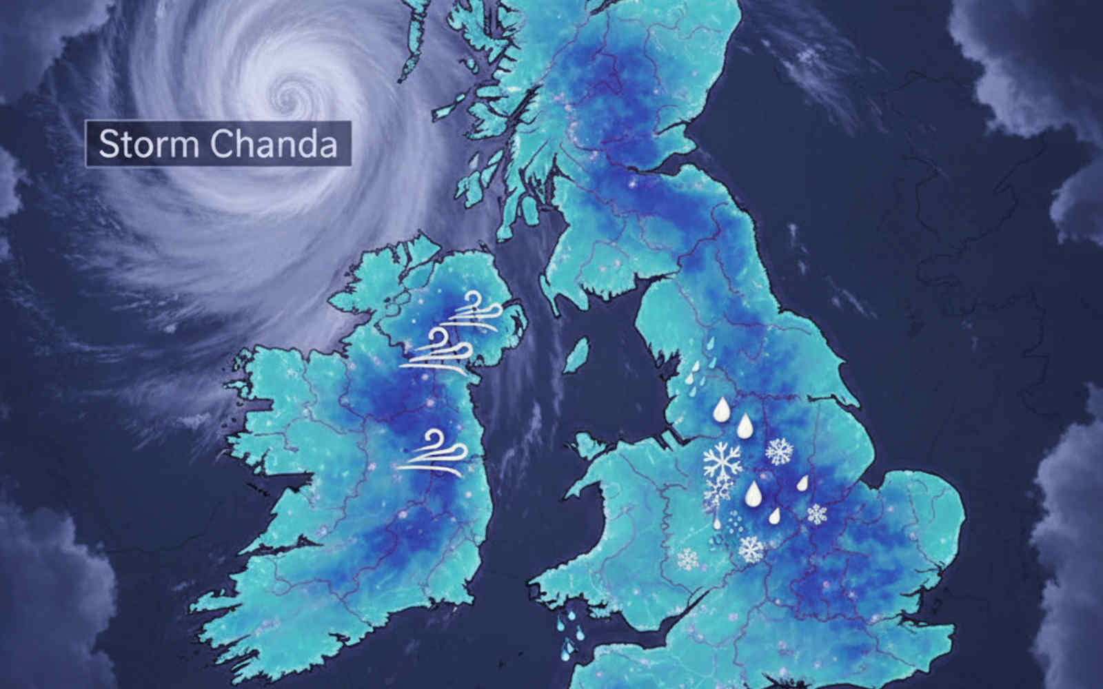
Storm Chandra has officially been named by the Met Office as the third major storm of the 2026 season. Arriving just days after the devastation of Storm Ingrid, Chandra is a complex, “multi-hazard” weather system set to bring a dangerous combination of disruptive snow, torrential rain, and life-threatening gale-force winds.
With saturated ground across much of the UK, the risk of flash flooding and landslides is significantly elevated. This post will be updated live as the system moves across the country.
🔴 LIVE UPDATES
Storm Chandra has officially been absorbed into a larger low-pressure system to the northwest, but its effects are very much still being felt. While the “named” storm is over, the ground is so waterlogged that a Major Incident remains in effect for Somerset.
Here is the practical breakdown for today, Wednesday, 28 January 2026:
🌊 The Somerset “Major Incident”
Despite Chandra clearing out, Somerset Council and the Environment Agency have kept the Major Incident status active.
- The Problem: Rainwater from the storm is still moving through the river systems. With the ground saturated, there is nowhere for the water to go.
- The Impact: Around 50 properties have been flooded so far (Ilminster, Taunton, and West Camel are among the hardest hit).
- The Solution: Heavy-duty mobile pumps are being deployed to Northmoor and other parts of the Somerset Levels, but they aren’t expected to be fully operational until Thursday evening.
⚠️ Severe Flood Warning (Danger to Life)
As of this morning, a Severe Flood Warning was issued for Iford Bridge Home Park near Christchurch, Dorset.
- The River Stour is rising rapidly, and residents have been told to evacuate “as quickly as possible” due to deep, fast-flowing water.
🚗 Travel & Transport
- Roads: The A35 at Winterbourne Abbas and the A352 at Charminster remain heavily flooded.
- Rail: The “black alert” at Dawlish (which we covered yesterday) and other South West closures are still causing major delays as engineers wait for water levels to recede before inspecting tracks.
🌦️ What’s Next? (Storm Joseph)
Chandra might be gone, but the “conveyor belt” of Atlantic lows hasn’t stopped.
- Tomorrow (Thursday): A new Yellow Warning for rain is already in place. This is where Storm Joseph comes in.
- The Met Office expects another 20-25mm of rain. While that’s not a huge amount on its own, because of Chandra’s leftovers, it’s expected to cause immediate run-off and further flooding.
Summary: Chandra is “dead,” but the flood risk is peaking right now as the water moves from the hills to the plains.
10:00 28th January 2026 – Post-Chandra Morning Report: Major Incident Active & The Dawn Freeze
While the winds have eased for most of the UK, the combination of record-breaking rainfall and sub-zero overnight temperatures has created a hazardous environment.
🚨 Emergency Operations: Somerset Major Incident
- Official Status: Somerset Council and the Environment Agency (EA) declared a Major Incident overnight.
- The Levels: Water levels on the Somerset Levels and Moors are rising rapidly. Pumping stations are running at maximum capacity, but the EA warns that many pumps can only operate when there is enough “headroom” in the rivers to receive the water.
- Property Flooding: Over 50 properties are confirmed flooded, with major concerns now focused on Saltmoor and Northmoor, where a flood warning was issued late last night. Six additional high-volume pumps are being connected at Northmoor, with pumping expected to begin by Thursday evening.
- New Records: A rain gauge near Taunton recorded its wettest 7-day period on record (records going back to 1995), proving the sheer volume of water currently in the system.
❄️ The Morning Freeze (Yellow Ice Warning)
- The Hazard: The Met Office Yellow Warning for Ice remains in place until 10:00 AM (right now) across a huge swathe of the UK, including the North East, Midlands, and South East.
- Commute Chaos: Reports of “patchy ice” and black ice on untreated surfaces have led to multiple minor collisions and slips. Temperatures plummeted to -3°C in rural areas overnight.
- Lake District: Wrynose Pass remains treacherous and largely closed following yesterday’s multiple rescues.
🚆 Transport & Infrastructure Update
- Dawlish Sinkhole & Wall Breach: A significant 8m x 3.5m sinkhole has opened up near the railway line between Dawlish and Teignmouth following the sea wall breach.
- South West Rail Cut-Off: The Great Western Main Line is severed between Exeter St Davids and Newton Abbot. There are currently no trains between Castle Cary and Taunton due to flooding at Hele.
- Advisory: Passengers between London and the South West are being redirected via Bristol.
- Roads: The A30 in Devon remains closed near Exeter Airport due to significant flooding. The M50 Northbound (J13-J12) closure is still causing massive local tailbacks.
🌊 Coastal & River Updates
- Cliff Danger: Access to the beach at Birling Gap (East Sussex) remains closed following yesterday’s cliff fall and the emergency rescue of nine people.
- River Peaks: The River Otter and River Wey are starting to recede very slowly, but they remain “raging torrents.” The EA warns that the flood risk will persist for the rest of the week due to slow drainage.
⚠️ Looking Ahead: The “Joseph” Moisture Surge
The “Atlantic Door” remains wide open.
- Thursday Warning: The Met Office is already flagging a fresh band of heavy rain for Thursday afternoon.
- Impact: With the Somerset Major Incident ongoing and the ground 100% saturated, even a standard rain system from Storm Joseph (currently off Portugal) could trigger a second peak in river levels.
23:00 27th January 2026 – Nightfall Report: Major Incidents, Ice Threats, and the “Joseph” Shadow
The UK is currently transitioning from an active wind/rain event into a dangerous freezing overnight period. Emergency services remain on high alert as “Danger to Life” flood warnings persist into the night.
🚨 Major Incident & Flood Crisis
- Somerset “Major Incident”: Somerset Council has declared a Major Incident tonight. Over 50 properties are confirmed flooded across Taunton, Ilminster, and surrounding villages. Emergency teams are working through the night as water levels on the Somerset Levels continue to rise.
- Severe Warnings Active: The “Danger to Life” warnings for Ottery St Mary (Devon) and the Upper Frome (Dorset) remain in place. The River Otter peaked at a record-breaking 2.83m, and while levels are slowly stabilizing, the threat remains critical.
- National Totals: As of 23:00, there are 112 Flood Warnings (flooding expected) and over 200 Alerts active across England alone.
❄️ The North: Ice and Snow Transition
- The “Black Ice” Clock: At 00:00, the Met Office Yellow Warning for Ice begins for Northern Ireland, Cumbria, the North-East, and parts of the South-East (Kent/Sussex).
- Wrynose Pass: Remains CLOSED. After a day of mountain rescues, the road is considered impassable due to sheet ice.
- A66 (Update): While currently open, gritters are in a “constant battle” with freezing temperatures. National Highways warn that any further precipitation will turn instantly to ice.
🚆 Transport & Infrastructure Shutdown
- Rail Severed: The rail line between Exeter St Davids and Newton Abbot remains shut due to the sea wall breach at Dawlish. Additionally, the line at Hele is still underwater, blocking the Taunton-Exeter route.
- M50 Northbound: The closure between J13 and J12 remains in place. Diversions are heavily congested and hazardous due to surface water.
- Isle of Man: Effectively cut off for the night. All ferry crossings were cancelled, and the A18 Mountain Road is closed until at least Wednesday morning.
⚡ Power & Utilities
- National Outage: Total properties without power have peaked at approximately 35,000 today. NIE Networks and SSEN report that while some reconnections have been made, many rural areas in NI and Devon will remain in the dark tonight as it is too dangerous for crews to work at height in the current gusts.
⚠️ PREPPER ALERT: Storm Joseph Tracking
Storm Joseph is currently intensifying off the Portuguese coast.
- The Track: It is moving North-Northeast.
- The Threat: While Joseph may stay offshore, it is dragging a massive plume of Atlantic moisture toward the UK. This “moisture surge” will hit our saturated ground by Thursday, meaning the flood recovery window is incredibly small.
19:00 27th January 2026 – The Big Freeze Begins: Pennine Gridlock, Cliff Falls, and the “Highest Pub” Rescue
As darkness sets in, the focus of the emergency is shifting. While the South remains submerged and battered by coastal surges, the North is entering a period of life-threatening ice and snow accumulation.
❄️ Northern England & Scotland: Snow and Ice Crisis
- The Pennine Trap: High-level routes are in a state of flux. The A66 has officially REOPENED between Brough and Bowes after being cleared by snowploughs, but National Highways warns of “extreme caution” as temperatures plummet.
- B6276 Blockade: The route from Brough to Middleton-in-Teesdale remains treacherous. Westmorland and Furness Council confirms it is “only passable with extreme care” and is totally unsuitable for HGVs.
- Wrynose Pass Emergency: Police and Mountain Rescue teams have been deployed to Wrynose Pass in the Lake District to rescue motorists stranded in “treacherous icy conditions.” The pass is now CLOSED until further notice.
- Tan Hill Inn Freed: After being trapped for hours, 21 people (including a 6-month-old baby) have finally been able to leave Britain’s highest pub. A convoy of 4x4s and a local farmer’s tractor cleared a path through the drifts.
🌊 Southern England: Coastal Collapse and Rescues
- Birling Gap Cliff Fall: In a dramatic rescue at 14:30, HM Coastguard winched nine people and a dog to safety in East Sussex. A cliff fall destroyed the access steps to the beach, trapping two families. The National Trust has now CLOSED beach access at the Seven Sisters indefinitely.
- Torcross & Weymouth: The destruction at Torcross continues to be monitored as waves literally smash through residential windows. In Weymouth, the River Wey remains at near-record levels, keeping parts of the town underwater.
- Historical Infrastructure: Campaigners at Powick Old Bridge (Worcestershire) warn that the 15th-century structure is under “critical stress” due to a massive buildup of storm debris against its already weakened arches.
🇮OM Isle of Man: Total Disruption
- Island Shutdown: Storm Chandra has effectively isolated the Isle of Man. All ferry crossings and most flights have been cancelled. The A18 Mountain Road remains closed, and widespread fallen trees have paralyzed bus routes in the West.
🚆 Rail & Transport Summary
- Hele Flooding: The main line between Taunton and Exeter remains CLOSED due to deep flooding at Hele.
- Northern Ireland: Whitehead Station is closed to passengers; a bus substitution is in place to Carrickfergus.
- M50 Northbound: The closure at J13–J12 remains the primary bottleneck for the evening.
⚠️ YELLOW WARNING: The Overnight Freeze
The Met Office has issued a Yellow Warning for Ice effective from 00:00 to 10:00 GMT Wednesday.
- Affected Areas: Cumbria, North East England, Kent, and East Sussex.
- The Risk: Wet roads from today’s rain will flash-freeze. “Black Ice” will be a major hazard for the Wednesday morning commute.
17:00 27th January 2026 – Structural Breach: Torcross Smashed, Dawlish Line Severed, and “Bio-Hazard” Floodwaters
As darkness falls, Storm Chandra is transitioning from a rainfall event to a destructive coastal surge. We are seeing reports of structural failures in residential homes and the total severance of the rail link to the South West.
Active Emergencies & Coastal Destruction
- Torcross Seafront Smashed: In a terrifying scene at Torcross (Devon), residents describe “warzone” conditions. Powerful waves have ripped protective shutters from homes and lifted beach shingle with enough force to smash through windows. Water is now free-flowing into several seafront properties.
- Kellswater Breach (NI): In Northern Ireland, the Kellswater River has burst its banks. Localized flooding is impacting surrounding fields and low-lying property.
- River Wey (Dorset) Record: Heavy overnight rain in Weymouth has pushed the River Wey to one of its highest levels in living memory. The peak occurred in the early hours, but levels remain dangerously high.
Transport & Rail Infrastructure
- Taunton-Exeter Closure: The railway is now officially CLOSED between Taunton and Exeter St Davids. This is due to severe flooding at Hele, which has submerged the tracks.
- Whitehead Station (NI) Closed: Passengers on the Larne line cannot board or alight at Whitehead Station as it has been shut due to storm impacts. A bus substitution is currently operating between Whitehead and Carrickfergus.
- M50 Northbound: The full closure remains in place between J13 and J12. Traffic is being diverted, but local routes are heavily congested.
- Wales Gusts: Earlier today, Wales bore the brunt of the wind with gusts of 62mph recorded at Milford Haven and Aberporth.
Biological Hazard & Public Health
- Sewage Warning: The Environment Agency and local prepper networks are amplifying the “Biological Hazard” alert. With almost all local rivers now contaminated by surcharging sewers, floodwater is toxic.
WARNING: Do not allow children or pets near floodwater. Raw sewage contamination is widespread in Cornwall and Wiltshire.
16:00 27th January 2026 – Major Incidents Declared: M50 Gridlock, Rail “Black Alert,” and Northern Blizzard
As we enter the late afternoon, the combined impact of Storm Chandra and the preceding Storm Ingrid has pushed the UK’s resilience to its limit. Multi-agency partners are now in emergency meetings across Northern Ireland, Devon, and the North of England.
Active Emergencies & Flood Response
- M50 “Major Event” Status: Transport Infrastructure Ireland (TII) has declared a Major Event on the M50. The Northbound stretch between J13 (Dundrum) and J12 (Firhouse) remains FULLY CLOSED due to extreme flooding. Tankers and high-volume pumps are on-site, but there is currently no estimated time for reopening.
- Severe Flood Warnings: Two “Danger to Life” warnings remain in place. While the River Otter (Devon) is the primary concern, a second Severe warning is now active for the Upper Frome at Dorchester.
- Biological Hazard Alert: Public Health warnings are being amplified: All floodwater is currently considered contaminated with raw sewage. If you have come into contact with water in Stithians (Cornwall) or flood-hit parts of Wiltshire, monitor for symptoms of gastrointestinal illness.
Transport & Rail Infrastructure Failure
- Dawlish Sea Wall “Black Alert”: Network Rail has confirmed that the sea wall at Sea Lawn Terrace, Dawlish, has suffered a significant breach. Tonnes of debris and track ballast have been washed away. All rail services between Exeter St Davids and Newton Abbot are SUSPENDED. This is the first time two “Black Alerts” of this magnitude in have been made in years, effectively cutting off the rail link to Plymouth and Cornwall.
- Trans-Pennine Blizzard: The A66 remains closed. On the M62, visibility has dropped to near-zero at Rishworth Moor. National Highways are reporting multiple abandoned vehicles in the “Snow Trap” zones of the southern Pennines.
- Aviation: Belfast City Airport has now surpassed 30 cancelled flights. Aer Lingus and British Airways have suspended most short-haul connections to the mainland.
Power & Community Impact
- Northern Ireland Peak: Over 300 schools remained closed today. 10,000+ homes in NI are currently without power, with NIE Networks warning that the 75mph “Easterly” gales are making it unsafe for crews to ascend towers for repairs.
- Nationwide Total: Total homes without power across the UK and Ireland has now hit 35,000.
15:00 27th January 2026 – Biological Hazards, M50 Closure, and Rail Infrastructure Failure
As we move into mid-afternoon, the crisis has shifted from a “weather event” to a “public health and infrastructure emergency.” Local authorities are now warning that floodwaters are heavily contaminated.
Active Emergencies & Flood Response
- M50 Northbound Fully CLOSED: A full road closure is now in effect on the M50 Northbound between J13 (Dundrum) and J12 (Firhouse) due to severe flooding. Nutgrove Avenue is also reported as impassable.
- Cornwall Rescue Ops: Cornwall Fire and Rescue Service has confirmed a successful water rescue in Lostwithiel this afternoon. A driver became trapped in deep, fast-flowing water. The service is repeating its urgent plea: Do not drive through floodwater.
- Sewage Contamination: Reports are flooding in from Stithians (Cornwall) and parts of Wiltshire where raw sewage is surcharging into streets and homes. The Environment Agency has confirmed that many septic tanks and sewer systems are now inundated. Assume all floodwater is contaminated with raw sewage.
Transport & Rail Infrastructure
- Dawlish Sea Wall Crisis: Despite the line briefly reopening yesterday after Storm Ingrid, Storm Chandra has caused fresh damage. A “Black Alert” has been issued by Network Rail. The sea wall has partially collapsed at Sea Lawn Terrace, scattering tonnes of debris onto the tracks.
- Rail Suspension Update: Most services between Exeter and Newton Abbot are now suspended or heavily delayed by speed restrictions. CrossCountry services to/from Paignton are terminating at Exeter St Davids.
- Trans-Pennine (M62): Conditions remain “treacherous.” While not fully closed, the M62 at Rishworth Moor is down to a crawl with near-zero visibility.
Power & Community Impact
- Health Hazard Alert: Local MP Perran Moon has described the sewage situation in Cornish villages as a “serious health hazard.”
- NI Wind Peak: The 75mph gales in Northern Ireland continue to batter the coast. Damage to the Larne Promenade has been reported, with the public urged to stay away from the seafront.
14:00 27th January 2026 – National Gridlock: M50 Flooded, M62 Blizzard, and Emergency Rescues Pass 35
As of 2:00 PM, Storm Chandra is delivering a coordinated blow to the UK’s transport network. We are now seeing “Severe” disruption across almost every major English and Welsh motorway corridor.
Active Emergencies & Flood Response
- River Otter Record Confirmed: The River Otter has officially stayed at its record peak of 2.83m, with extensive flooding still inundating Ottery St Mary. Some areas reporting bank breaches.
- The M50 Crisis: The M50 (Ross-on-Wye to Tewkesbury) is seeing significant standing water and localized flooding. Traffic is heavy and slow-moving; National Highways is monitoring the route for a potential full closure if levels rise further. – UPDATE: We are currently getting uncomfirmed reports that the M50 may be closed to all traffic
- Mass Rescue Update: Fire and rescue teams have now pulled over 35 people from submerged vehicles across Devon, Somerset, and South Wales.
- Northern Ireland: The Amber Wind Warning remains in full force. Damage to seawalls in Co. Down is being reported as the “Easterly” swell batters the coast.
Major Transport Gridlock
- M62 “High Alert”: Snow is now accumulating rapidly on the M62 at Rishworth Moor. Visibility is near zero in places. Drivers are being advised to avoid the trans-Pennine crossing entirely.
- A66 Closure Extended: The A66 remains closed with no estimated reopening time as ploughs struggle against 20cm+ drifts.
- M48 Severn Bridge: Currently OPEN but with restricted 40mph speed limits. If gusts exceed 46mph again, a closure will be immediate.
- A35 Closure: The A35 is now closed in both directions between the A352 (Dorchester) and B3150 due to flooding.
- Rail: Nearly all services between Exeter and Taunton are suspended. Heavy flooding on the tracks near Cowley Bridge has rendered the line impassable.
Power & Community Impact
- School Closures: The number of closed schools has risen to over 350 in Northern Ireland and roughly 50 in Devon, as transport for students became impossible.
- Power Outages: Approximately 30,000 homes are now without power nationwide. UK Power Networks warn that the combination of wind and saturated ground is toppling trees onto lines at an accelerated rate.
13:00 27th January 2026 – Trans-Pennine Routes Gridlocked & “Silent” Warning Outcry
As we reach the middle of the day, Storm Chandra is exerting maximum pressure on the UK’s infrastructure. While rain persists in the South, the “Snow Line” has effectively severed major arterial routes between the East and West of England.
Active Emergencies & Flood Response
- Red Warning Persistence: The Red “Danger to Life” Flood Warning for the River Otter at Ottery St Mary remains active. Local residents report the river is now a “raging torrent,” with water levels continuing to hover at record-breaking heights.
- Water Rescues: Fire and Rescue services in Devon and Somerset have now surpassed 30 successful rescues of individuals trapped in vehicles. The message remains clear: Do not drive through floodwater.
- Northern Ireland Wind: The Amber wind warning for Counties Antrim, Down, and Derry is now at peak intensity. Local reports of “unusual” easterly damage—including structural failures of seawalls and fences—are increasing.
Major Transport Gridlock
- M62 Standstill: Conditions on the M62 between Junction 21 (Milnrow) and Junction 22 (Rishworth Moor) have deteriorated. Multiple jackknifed lorries and heavy snow have brought trans-Pennine traffic to a virtual halt.
- A66 Remains Shut: The A66 remains closed in both directions between Bowes and Brough. National Highways have confirmed that snow drifts of up to 20cm are being reported on higher ground.
- A30 & A303 (Update): These major South West arteries remain CLOSED due to deep standing water and active flooding. National Highways crews are on-site but cannot begin clearance until water levels recede.
- Rail Shutdowns: CrossCountry services between Taunton and Exeter St Davids are suspended until at least 14:15. Transport for Wales has also confirmed that the line between Hereford and Newport is blocked due to flooding.
Power & Community Impact
- Schools: Over 300 schools across Northern Ireland and approximately 45 schools across Devon/Somerset are now confirmed closed for the day.
- Outage Update: 20,000+ homes remain without power across the island of Ireland. In the UK, UK Power Networks and SSEN are reporting “complex repairs” required in coastal Devon where easterly gales have downed lines in waterlogged soil.
12:00 27th January 2026 – Record River Levels Breached & National Transport Gridlock
As Storm Chandra enters its peak phase, the Environment Agency has confirmed that river levels in the South West have officially surpassed historical records, while the “snow line” in the North is causing critical failures on the trans-Pennine routes.
Severe Flood Crisis: Records Broken
- River Otter Records: The River Otter at Ottery St Mary has now reached its highest recorded level in history, surpassing the previous record set in December 2000.
- Tipton St John Submerged: Reports have confirmed that Tipton St John school has now flooded. The surrounding playing fields are described by residents as a “raging torrent.”
- Mass Rescue Totals: Devon & Somerset Fire & Rescue Service confirmed they have now rescued people from at least 25 vehicles stranded in floodwater since dawn.
Transport & Infrastructure Update
- M48 Severn Bridge (Update): The bridge has REOPENED in both directions as of 11:30, though it remains under close observation. High-sided vehicles are still advised to use the M4 Prince of Wales bridge.
- A30 & A303 Closures: The A30 is closed in both directions near Ottery St Mary (between B3174 and B3184). The A303 is also closed between Upottery and Horton Cross due to significant standing water.
- A66 (North): Remains CLOSED between Bowes and Brough due to heavy snow and blizzard conditions. National Highways warns that drifts are making the route impassable for all vehicles.
- Aviation: Belfast City Airport has now cancelled more than two dozen flights. Loganair has also suspended or adjusted services across the Hebrides and Isle of Man.
Regional Impacts
- Northern Ireland: Over 300 schools have now confirmed closures as the Amber wind warning continues. Ferries between Belfast, Larne, and Liverpool remain suspended.
- Wales: The A40 remains blocked between Abergavenny and Raglan. Transport for Wales reports a complete suspension of services between Swansea and Shrewsbury due to multiple fallen trees.
- London: Minor delays are now impacting the Bakerloo and Central lines, with severe delays on the Mildmay line between Willesden Junction and Clapham Junction.
Power & Utilities
- Outage Totals: Nationwide power outages have hit approximately 20,000 homes. Engineers are facing “extreme difficulty” reaching faults in the South West and Northern Ireland due to blocked roads and rising water.
11:00 27th January 2026 – Escalating Rescue Operations & Bridge Closures Confirmed
The scale of the emergency is becoming clearer as the morning progresses. Rescue operations are now underway across multiple regions.
Active Rescues & Evacuation
- Motorists Trapped in Floodwater: Multiple reports of drivers stranded in vehicles submerged in flash flood zones across Devon and Somerset. Emergency services are conducting active water rescues. Do NOT attempt to drive through flooded roads—even 30cm of moving water can sweep a vehicle away.
- Evacuation Ongoing: Local authorities continue door-to-door evacuations in Ottery St Mary and surrounding areas as the Red flood warning remains in effect.
Major Transport Infrastructure Now Closed
- M48 Severn Bridge (Wales/England): CLOSED (confirmed by National Highways). No estimated reopening time given.
- Humber Bridge (East Yorkshire): CLOSED to high-sided vehicles and caravans due to extreme winds gusting 60+ mph.
- Rail Closures Expanding: South Western Railway and Great Western Railway lines remain blocked. Network Rail is reporting fallen trees across multiple lines in the South West.
Flood Warning Escalation
- Total Active Warnings: 21 Flood Warnings + 114 Flood Alerts now in place across England, Scotland, Wales, and Northern Ireland.
- Scotland: Heavy rainfall continues with 40-50mm already fallen in Aberdeenshire, Perthshire, and Angus. Persistent south-easterly airflow expected to continue through Sunday, bringing additional rainfall to higher ground.
Power & Infrastructure
- Outages continue across Northern Ireland, Devon, and Cornwall. Networks advise restoration may take several days in affected areas due to widespread damage.
09:30 27th January 2026 – Severe “Red” Flood Warning & Travel Shutdown
The most critical development this morning is a Red “Severe” Flood Warning (Danger to Life) issued for Ottery St Mary on the River Otter in Devon. Residents are being urged to move to safety immediately as deep, fast-flowing water is expected to inundate the town.
Flooding & Heavy Rain
- Devon & Somerset: Effectively “ground zero.” The River Exe and River Otter have burst their banks in several locations. Ottery St Mary is currently facing the highest risk.
- Road Closures: Sections of the A351 (Corfe Castle), the A40 (between Abergavenny and Raglan), and numerous local routes in East Devon and South Somerset are impassable.
- Volume: Over 80mm of rain has already fallen on Dartmoor since midnight. Saturated ground means immediate runoff is causing flash floods in urban areas.
- London & South East: A Yellow rain warning is active; heavy rain is currently impacting the morning commute with significant surface water on the M25 and A3.
Power Outages
- Northern Ireland: NIE Networks are reporting outages across Counties Antrim and Down as the Amber wind warning (75mph gales) took effect at 05:00.
- South West: Isolated power cuts reported in Cornwall and Devon, where the network was already weakened by Storm Ingrid last week.
Building & Structural Damage
- Fallen Trees: Devon County Council and Gwent Police have reported “blocked roads at several key locations” due to fallen trees.
- Northern Ireland: Reports of minor structural damage (tiles, fences, and shed roofs) are emerging from coastal towns like Newcastle and Ballymoney due to the unusual Easterly wind direction.
Snow & Winter Hazards
- Pennine Closures: The A66 is officially CLOSED westbound at Bowes (County Durham) due to heavy snow and drifting.
- M62 Warning: While currently open, National Highways are advising against trans-Pennine travel as snow begins to accumulate on the highest sections.
- Scotland: Heavy snow is moving into the Highlands and Southern Uplands; the A77 near Cairnryan was blocked earlier this morning by fallen trees combined with slushy conditions.
Transport Disruption
- Rail: Major disruption on South Western Railway and Great Western Railway. Lines are blocked between Exeter and Barnstaple/Okehampton, and between Salisbury and Southampton due to flooding.
- Bridges: The M48 Severn Bridge is CLOSED. The Humber Bridge is closed to high-sided vehicles.
- Ferries: Widespread cancellations on the Irish Sea. Sailings between Belfast/Larne and Liverpool/Cairnryan are suspended.
- Air: Dozens of flights have been grounded or delayed, particularly at regional airports in the South West and Northern Ireland.
Emergency Note: Over 30 schools across Devon and Somerset have been confirmed closed this morning. If you are in the South West, local police are advising “Do not travel” unless it is an absolute emergency.
00:00 27th January 2026 – Major Flooding Imminent & Amber Wind Warning Active
Storm Chandra is now making a direct hit on the UK. The Met Office has warned that the window for preparation has closed in the South West as torrential rain moves in.
- Amber Wind Warning (Northern Ireland): Effective from 05:00 today. Easterly gusts of 75mph are expected to cause widespread tree falls and power outages across Antrim, Down, and Derry.
- Amber Rain Warning (South West): Currently active. South Somerset, Devon, and Dorset are seeing extreme rainfall. Fast-flowing floodwater is now a significant risk to life in towns like Yeovil, Taunton, and Chard.
16:00 26th January 2026 – Amber Alerts Activated & Coastal Warnings
- Amber Rain Warning (SW England): Now active for south Devon, Dorset, southern Somerset, and southeast Cornwall. Up to 80mm of rain is expected on saturated ground—significant flooding is “probable.”
- Amber Wind Warning (Northern Ireland): Rare easterly gales of 75mph are forecast for Tuesday. These unusual wind directions increase the risk of uprooted trees and structural damage.
- Snow Escalation: Yellow warnings are now in place for Scotland and Northern England. Expect 10–20cm of snow on ground above 500m, with travel disruption likely on the M62 and A66.
- London Alert: A Yellow rain warning has been added for the South East, including London, valid from midnight tonight.
14:15 26th January 2026 – AMBER Warnings Issued: Danger to Life Alerts
The Met Office has significantly upgraded its warnings as Storm Chandra tracks closer to the UK. The following alerts are now active:
- Amber Wind Warning (Eastern Northern Ireland): Valid from 05:00 to 21:00 Tuesday. Gusts of 70-75mph are expected. This is particularly dangerous as these are easterly winds, which are unusual for this region and likely to cause structural damage and uproot trees.
- Amber Rain Warning (South West England): Valid from 17:00 today (Monday) until 09:00 Tuesday. Covers South Devon, Dorset, and South Somerset. Expect 60-80mm of rain on already saturated ground.
- Yellow Snow Warning (Scotland & Northern England): Significant snow is forecast for the early hours of Tuesday. Higher routes (above 500m) could see 20cm of accumulation, with 2-5cm possible at lower levels, including parts of Greater Manchester and the Pennines.
12:30 GMT (Monday 26 Jan) — Next storm officially named “Storm Chandra“
Where and Why Storm Chandra Formed
Storm Chandra originated as a deep area of low pressure in the North Atlantic. It was fueled by a powerful jet stream—a core of strong winds roughly 8-11km above the Earth’s surface—which acted as a conveyor belt, intensifying the system as it moved toward the British Isles.
The storm underwent rapid intensification (a process sometimes called “explosive cyclogenesis”) as it drew up warm, moist air from the south and collided with a block of cold polar air sitting over northern England and Scotland. This interaction is the primary driver behind the significant snowfall predicted for northern regions.
Expected Weather Conditions
- Extreme Winds: Coastal areas, particularly in Northern Ireland and Southwest England, are braced for gusts between 60mph and 80mph.
- Heavy Rainfall: Widespread rainfall of 20-30mm is expected, with up to 80mm possible over higher ground such as Dartmoor and the Brecon Beacons.
- Significant Snowfall: As the rain hits cold air in the North, it will turn to snow. Forecasters expect 2-5cm at lower levels in the North, with 10-20cm accumulating on ground above 500 meters.
- Coastal Surge: Large waves and spray are expected to batter sea fronts, posing a “danger to life” from flying debris and beach material.
Primary Impact Zones
The Met Office has issued a “patchwork” of warnings across the UK:
- Northern Ireland (Amber Warning): Eastern and northern coasts are expected to see the strongest easterly winds, peaking at 75-80mph.
- Southwest England (Amber Warning): South Devon, Dorset, and Somerset are under high alert for flooding due to persistent heavy rain on already saturated ground.
- Northern England & Scotland (Yellow Warning): Significant travel disruption is expected due to hill snow and blizzard conditions on high-level routes.
- Wales & Midlands (Yellow Warning): Heavy rain and blustery conditions likely to cause local flash flooding.
Potential Impacts to the UK
- Travel Disruption: Expect cancellations on ferry services (Irish Sea), rail delays due to fallen trees, and hazardous driving conditions on the A66 and M62 due to snow and spray.
- Flooding: Because the ground is already saturated from Storm Ingrid, even moderate rainfall is likely to cause immediate runoff, leading to flash floods and potential landslides in prone areas. Make sure your Grab Bag is ready to go in case you need to evacuate.
- Power Outages: High winds are likely to impact overhead power lines, particularly in rural parts of Northern Ireland and Cornwall. Make sure you have a blackout box ready at hand and fully stocked.
- Structural Damage: Risk of tiles being blown from roofs and damage to temporary structures/fences. Make sure your Grab Bag is ready to go in case you need to evacuate.
- Take photographs of your belongs NOW in case you need them later for insurance purposes.
🧠 UK Prepper Hub Tip:
If you are in an Amber warning area, ensure your “Grab Bag” is ready and check your local flood risk. Do not attempt to drive through floodwater; as little as 30cm of moving water can move a car.
📡 Find Us Everywhere
Daily briefings, prep guides, and real-time updates across every platform. Pick yours.
Free. No commitment. Stay anonymous on WhatsApp & Telegram.
Stay Informed on UK Preparedness
Join our newsletter for UK-specific preparedness tips, product recommendations, and real-world advice for households.
Subscribe to Our Newsletter